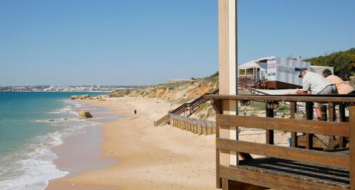
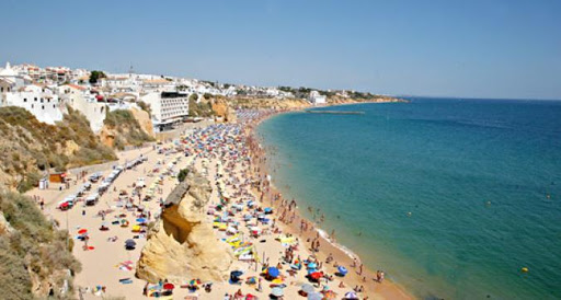
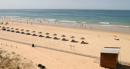
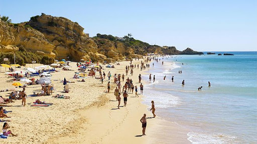
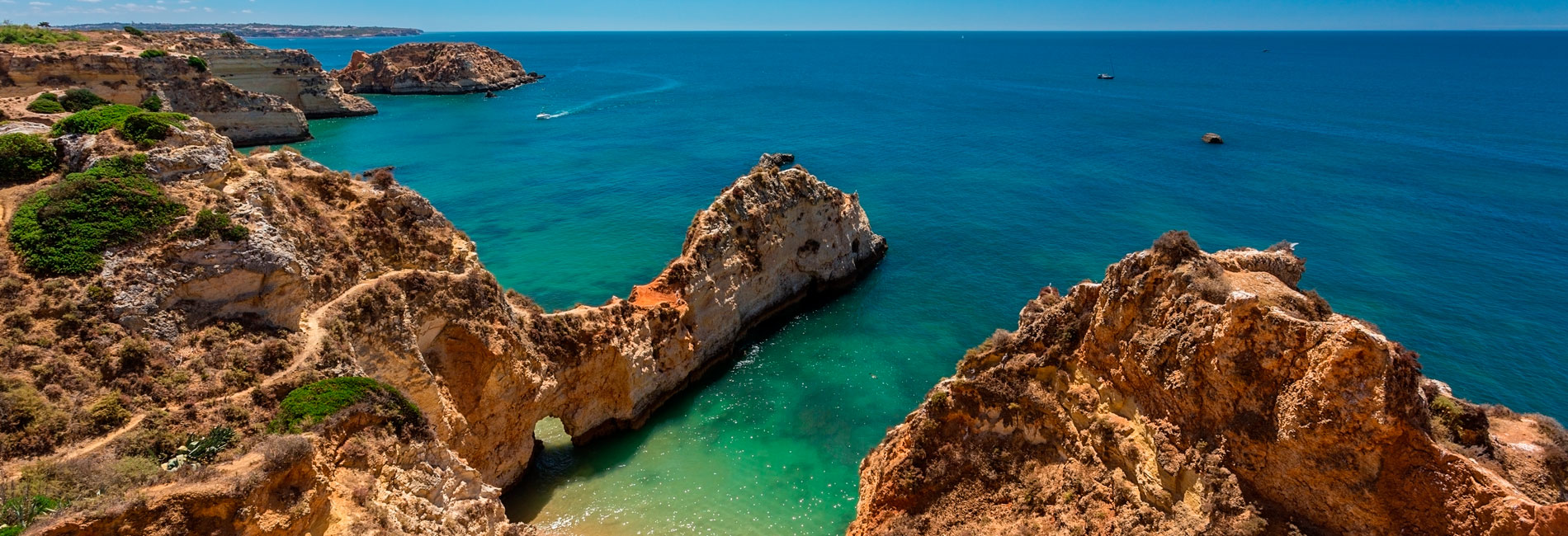
Albufeira
The city of Albufeira was called 'castle of the sea' by the Arabs ('Al-Buhera', as it was known in the 8th century) and it had an amphitheatre overlooking the sea. Today, Albufeira and its surrounding region is one of Portugal's main tourist destinations, offering almost 30 kilometres of coastline and more than two dozen beaches that vary greatly from one another in terms of natural surroundings, occupancy and tourism options.
As an internationally renowned destination, Albufeira is known for its rich and diverse cuisine as well as the wide variety of restaurants it boasts (serving regional specialities and refined French, Italian or Germany dishes). Linked closely to the sea, this region's seafood enjoys a starring role in local gastronomy.
Although tourism activities and the nightlife on the Algarve are famed, there is another reality here: quiet villages where manual arts such as tile making, copper working and wickerwork exist among dry lands with almond trees in flower and colourful orange groves.
There are several types of beaches available and 20 to choose from, meaning there is something for everyone in Albufeira.
FISHERMAN'S BEACH
+
FISHERMAN'S BEACH
Situated in the center of Albufeira, this beach is much sought after by holidaymakers. It operates a small port for fishing boats, and from here, it is possible to visit the caves on the coast. Hidden in a rock is a sewer that emits an unpleasant odor. It has a diversified catering area, small shops and bars, as well as a shed with garden benches, delicious shadows and views of the sea.
GPS N + 37 ° 5 '12.66 ", W -8 ° 14' 59.33"
Source of photography: http://www.iberica360.com/pano/pano.php?id=17
SALGADOS BEACH
+
SALGADOS BEACH
Salgados Beach is very popular because of its unusual characteristics and because it is the only wetland in the municipality of Albufeira, it is one of the most diversified in the Algarve with regard to bird life. The beach develops near a coastal lagoon frequented by migratory birds and in summer, calm and good quality waters attract hordes of visitors who irresponsibly disrespect the warnings to stay away from the lagoon, an important nesting zone.
GPS N 37º 5' 17.59'', W -8º 19' 31.77;
Source of photography: http://www.iberica360.com/pano/pano.php?id=18
GALÉ BEACH
+
GALÉ BEACH
It is said that the origin of the name is due to the fact of having shipwrecked a galé (Vessel of war) in the beach, prevailing then the name of Beach of Galé. This beach is constituted by two components that are divided by a cliff, yet they are connected by stairs. Galé Oeste beach extends to the Salgados beach, while the Galé Este beach is bordered by cliffs, except at low tide in the sunniest months and its sand is extensive and good quality water.
GPS N 37º 4' 56.89'', W -8º 19' 6.93;
Source of photography: http://www.iberica360.com/pano/pano.php?lang=&id=12
PRAIA DO MANUEL LOURENÇO
+
PRAIA DO MANUEL LOURENÇO
Small sand located between Praia da Galé Leste and Praia do Evaristo, has a very cliff top with peculiar shapes. It has a rocky platform that at low tide allows to go to the discovery of marine life between tides.
GPS N 37º04'35.63; W 8º18'33.99;
Source of photography: http://www.iberica360.com/pano/pano.php?id=13
EVARISTO BEACH
+
EVARISTO BEACH
It owes its name to the restaurant of the place. The beach is pleasant and rocky, with a shallow beach that, in summer, resembles a mall on a rainy day. The access is made by the same road that leads to the elitist Clube Casa do Castelo, where the Portuguese jet set is jostled.
GPS N 37º04'27.36; W 8º18'08.11;
Source of photography: http://www.iberica360.com/pano/pano.php?id=14
CASTLE BEACH
+
CASTLE BEACH
In the surrounding of the beach dominates the deep green of the pine forests. In the flattened top of the leixões also dominates the green, this time of plants adapted to the marine environment like the barilla, the salgadeira and the fennel. Several seabirds, such as hawks or cormorants, enjoy these sites inaccessible to terrestrial predators.
The hike through the cliffs is favored here, discovering small coves and observing geoforms generated by erosion, mainly algares and caves. However, caution is advised and a safe distance from the edge of the cliffs should be kept.
GPS N 37º 4' 23.55'', W -8º 17' 55.52; Source of photography: http://www.iberica360.com/pano/pano.php?id=29
COELHA BEACH
+
COELHA BEACH
Nestled among golden cliffs, Coelha Beach is a small beach sheltered by winds. Located about 5 kms west of Albufeira, it is a busy beach during the summer. On the cliffs of warm colors are visible marine fossils, as well as caves and galleries resulting from the erosion of fresh and salt water on the limestone. We recommend caution in the use of this beach, classified as a beach of limited use due to the possibility of overthrows.
GPS N 37º 4' 23,05'' ,W 8º 17' 15,35;
Source of photography: http://www.iberica360.com/pano/pano.php?id=30
SAO RAFAEL BEACH
+
SAO RAFAEL BEACH
São Rafael is a stunning, family-friendly beach nestled among warm limestone cliffs, offering visitors an expansive golden sand. When the transparency of the water allows, the mysterious outline of the submerged rocks can be glimpsed, and a mask and fins walk reveals the marine life that abounds in this stretch of coast.
GPS N 37º 4' 28.85'', W -8º 16' 50.63;
Source of photography: http://www.iberica360.com/pano/pano.php?id=15
PENECO BEACH
+
PENECO BEACH
Located in the city's urban front, also known as Tunel Beach and this name is due to the fact that the beach is accessed by a tunnel excavated in the limestone cliff, situated between the narrow streets of the vibrant old town of Albufeira, where you will find many bars, inviting restaurants and craft shops. From the top of the top, it is also possible to descend to the sand by stairs in masonry that exist from the Dr. Frutuoso da Silva Esplanade.
GPS N 37° 5' 11.68'', W -8° 15' 10.39;
Source of photography: http://www.iberica360.com/pano/pano.php?id=16
MARIA LUISA
BEACH
BEACH
+
MARIA LUISA
BEACH
BEACH
The beach Maria Luísa offers you a great stretch of sand, framed by pine trees and cliffs of warm tones, polished at the bottom by the action of the sea. Highlights of the remains of a huge algar (natural well) that formed in the nascent area of the beach and which resembles a house with an arched door, missing one of the walls and the roof.
GPS N 37º 5' 23.38'', W -8º 12' 3.42;
Source of photography: http://iberica360.com/pano/pano.php?id=22
BEACH OF EAGLE
+
BEACH OF EAGLE
Inserted in the picturesque village of Olhos d 'Água, the beach owes its name to the existence of several freshwater springs on the beach by the sea and in the sea. It is a very popular beach, given its urban and tourist character, with a central square with terraces from where you can contemplate the sea and a small pedestrian promenade by the sea front, flanked by palm trees.
GPS N 37º 5' 23.01'', W -8º 11' 27.66;
Source of photography: http://iberica360.com/pano/pano.php?id=23#scene_pano1
BEACH OF THE BARRANCO DAS BELHARUCAS
+
BEACH OF THE BARRANCO DAS BELHARUCAS
Many birds take advantage of the forest area and some shelter and shelter nests on the rocky walls, as is the case of the colorful abelharucos that baptized the beach hence the name of this beach. The recommended access to the beach is pedestrian, either by the walk, or because the path may not be passable to vehicles. The trail is winding and runs through a ravine ripped in the top, where the vegetation grows luxuriantly and leafy.
GPS N 37º 5.45298 '; O 8º 11.00028 '
Source of photography: http://iberica360.com/pano/pano.php?id=24
PRAIA DA FALESIA
+
PRAIA DA FALESIA
Beach with a very extensive beach (about 3 km). It is one of the most frequented during the summer, mainly by families and especially during the bathing season. The cliff in orange and almost white shades provides a landscape of bright colors. The base is filled with greenery and the top filled by the apartments.
GPS N 37º 5' 4.04'', W -8º 9' 39.74;
Source of photography: http://iberica360.com/pano/pano.php?id=110
STONE BEACH
BASEBALL: BORN
BASEBALL: BORN
+
STONE BEACH
BASEBALL: BORN
BASEBALL: BORN
In addition to the name Rocha Baixinha, this is a beach also commonly known as Tomatos beach. Its location, near the Marina of Vilamoura, popular for nightlife and the familiar faces of Portuguese politicians, makes this beach one of the most sought after in the Algarve. Considered the fashionable beach, due to the numerous public figures - from politics to football - who frequent it during the summer months, Praia dos Tomates, is the reference point of the Portuguese beach map. The name of the beach is due to the fact that in times there had been near the beach a plantation of tomatoes that its producer sold along the beach.
GPS N 37º 4' 35,56'' ,W 8º 8' 2,26;
Source of photography: http://iberica360.com/pano/pano.php?id=26
ARRIFES BEACH
+
ARRIFES BEACH
This small cove is sheltered by low, intensely carved cliffs, where arches, arches and caves are visible. Small Areal surrounded by some rock formations that give it a special beauty. It is isolated and very quiet. With diving glasses and fins, you can see the bottom of the sea, as it has no restlessness.
GPS N 37 ° 4 '33.96 "; W 8 ° 16 '40.35 "
Photo Source: http://www.iberica360.com/pano/pano.php?id=27
INATEL BEACH
+
INATEL BEACH
The name of the beach derives from Inatel's own location. The beach is narrow and obeys the contours of the landscape itself. Looking to the right side, facing the sea, there is a pontoon that separates this beach from the following - Fisherman's Beach. It is an urban beach, very crowded.
GPS 38º 40´ 46” N; 9º 19´ 01
Source of photography: http://www.iberica360.com/pano/pano.php?id=19
BEACH OF THE GERMS
+
BEACH OF THE GERMS
In the times of the Canning Industry, the Inatel facilities were a factory owned by a family of German nationality, the adjacent beach called "Germans", a beach bounded by a cliff is much sought after by domestic and foreign tourists, the beach has a more naturalized surrounding , compared to the beaches of the more western zone in which the beach becomes progressively more tranquil to spring.
GPS N 37° 5’ 3.66”; W 8° 14’ 16.73;
Source of photography: https://www.visitportugal.com
BEAUTY BEACH
+
BEAUTY BEACH
Small beach, between rocks and sandy shells in full cliff, very beautiful, with good quality water. In this area, the sea does not leave anyone indifferent, because it is very calm and clear waters. . The sand is nestled between cliffs, forming a quiet rocky pool.
GPS N 37° 5’ 0.68”; W 8° 13’ 53.45;
Source of photography http://www.iberica360.com/pano/pano.php?id=28
PRAIA DA OURA
+
PRAIA DA OURA
Beach with an extensive beach delimited by a beautiful cliff, close to hotels and tourist villages, being much sought after by foreigners. There is a calm zone of baths, almost without undulation, privileging a series of sports modalities. The surroundings are characterized by the warm colors of the sand and cliffs, only softened by the deep green of the pines.
GPS N 37° 5’ 10.08”; W 8° 13’ 35.46;
Source of photography: http://www.iberica360.com/pano/pano.php?id=20
BEACH OF
SANTA EULÁLIA
SANTA EULÁLIA
+
BEACH OF
SANTA EULÁLIA
SANTA EULÁLIA
In St. Eulalia the blue sea and the luminous shades of the sand are harmoniously surrounded by the green and fresh atmosphere of the surrounding pine forest, the sandstone between cliffs with calm and good quality water, where you can swim at ease. The beach is wide, with many nice corners drawn by the rock formations.
GPS N 37° 5’ 16.85”; W 8° 12’ 52.43;
Source of photography: http://www.iberica360.com/pano/pano.php?id=21